 This project has received funding from the European Union’s Horizon 2020 research and innovation programme under grant agreement No 642224
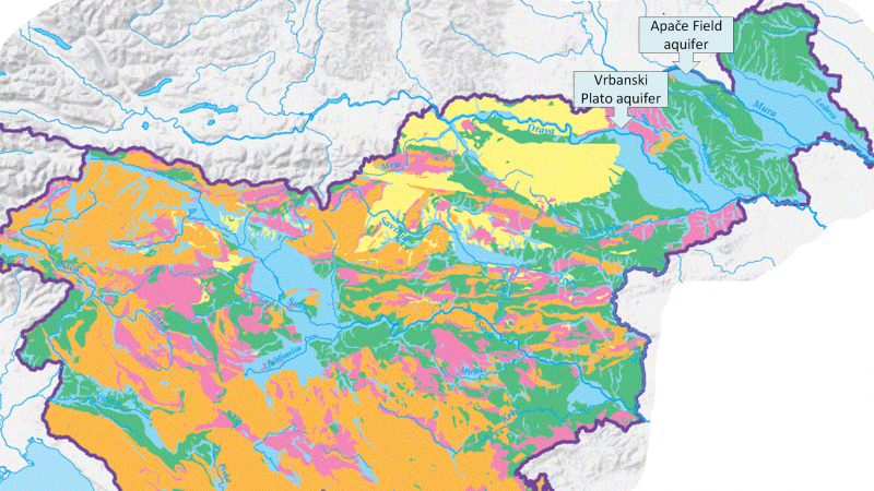
The QGIS/FREEWAT tool was within the GEOHIDRO project, which was a national project financed by the European Social Program and national thematic program »Creative Path to Practical Knowledge« intended primarily for the students of various faculties. The programme aims to connect students, companies and education in faculties. Within the project, student gained practical knowledge, experience and also made connections that can further advance their future careers. The goal of the project GEOHIDRO was to connect the student from geography and technical faculty and teach them how to made a good groundwater model with all necessary data. It was a brief project so the Consortium made only a steady-state groundwater flow model of the Apače Field aquifer. In the area of the Apače Field aquifer are two pumping stations, which represent one of the main sources of drinking water for the north-eastern part of Slovenia. Due to extensive farming in the area of the aquifer, an advanced artificial groundwater recharge system was constructed. Fort the goal of the project, FREEWAT was used to recognize the effects of the induced river bank filtration (IRBF) and managed aquifer recharge system (MAR) on the groundwater body.