Dear reader,
The FREEWAT project and Consortium is sailing across the foreseen activities without any major deviation. This fact is now allowing us to start having relevant dissemination activities aiming at maximizing FREEWAT exploitation at EU level and beyond. In fact, I’d like to acknowledge the fruitful cooperation created with UNESCO-IHP which allowed us having a relevant workshop in Paris (see more in this newsletter) and FREEWAT to be presented at COP22 in Marrakech last November.
All software capabilities are in place and running and if you wish to test them, just go to the Software section of the FREEWAT website, fill in the forms and ask to get the software. Up to 31st March 217, FREEWAT will be only available for training and testing, but… from April the 1st 2017, the Steering Group decided to free the software (in agreement with the EC) before the 30th September 2017 (as initially foreseen by the project Grant Agreement). By that date, you can get the software from the website only filling an online form.
Training activities will be running by beginning of 2017 in many countries in Europe and beyond, you can contact us in order to know when and where these training activities are running. By joining this free training you will get to learn the most relevant FREEWAT capabilities and you will have the opportunity to discuss issues with FREEWAT developers and first users… and, who knows, maybe join us for next FREEWAT development stage!
Fourteen case studies are running facing a wide range of natural and anthropogenic conditions. They are divided in case studies devoted to the application of the Water Framework Directive and to rural water management. Check those more interesting for your daily activities at the Case Study section of the web site.
Finally, at each case study Focus Groups are running. They aim at demonstrating the importance of participatory approach in water management. I must say, that although sometimes not easy, as different stakeholders are bringing different views and needs, this is an exciting activity. As I heard from some of the participants, having in mind the different perspectives provides new thoughts and ideas on the concept of sustainability of water planning and management.
So, there is a lot going on in the FREEWAT world – join us to get the most from FREEWAT approach and capabilities!
Rudy Rossetto
FREEWAT Project Coordinator
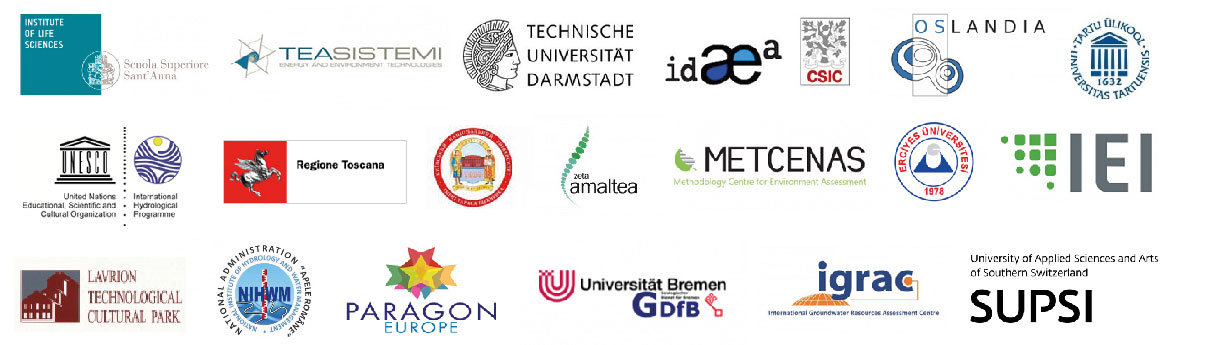
The Consortium
The project Consortium is made up of 19 partners representing various water sectors from 11 EU countries, Switzerland, Turkey and Ukraine and UNESCO international organization.
ICT for water to boost SDG6 and SDG8
The international workshop “Fostering inclusive and sustainable economic growth, employment and decent work (SDG#8) through ICT job creation tools for ensuring water security (SDG#6)” was co-organized by the EU HORIZON 2020 FREEWAT project (www.freewat.eu) and UNESCO- International Hydrological Programme (partner of the FREEWAT project) in cooperation with the EU ICT4WATER cluster, USGS, H2020 KINDRA, within the framework of the European Innovation Partnership MAR Solutions - Managed Aquifer Recharge Strategies and Actions (AG128). Altogether the 20 high level contributions informed and stimulated the debate about the positive influence of Information and Communication technologies (ICT) for water management to boost training and job creation thanks to the use of free and open access data and software.
Objectives and outcomes of the workshop
The 20 panelists and the 90 delegates representing 41 European and International institutions from 33 Countries discussed how using Information and Communication Technology (ICT) tools in the water sector can help to achieve targets related to SDG6 and SDG8. Three delegates from UNESCO welcomed the participants by giving an overview of the main activities of the hosting organization about the workshop themes. Mr Filiali-Meknessi briefly presented the Hydro Open-source software Platform of Experts (HOPE) Initiative (http://www.hope-initiative.net/ ) and its role to promote conjunctive use of surface- and ground-water includingmanagement of transboundary aquifers in Africa. Then, H. E. Mrs Vincenza Lomonaco (Ambassador at the Permanent Delegation of Italy to UNESCO) introduced the four plenary sessions by remarking the challenges and risks that relate reliable availability of an acceptable quantity and quality of water for health, livelihoods and production coupled with an inclusive and sustainable economic growth.
Highlights from the sessions
Mrs Jimènez-Cisneros, director of the Division of Water and Science at UNESCO introduced the first session by presenting the International Hydrological Programme (IHP) of which she is Secretary.
Following Mrs Achilleos, project advisor at the European Commission, discussed the challenges and opportunities for water research and innovation from the point of view of the Executive Agency for Small and Medium-sized Enterprises (EASME). Both the speakers highlighted how monitoring is critical to achieve the SDG6 and therefore that credible data are needed, especially for cross-sector approaches.
In this regard, Mr Picavet, owner and manager at Oslandia (France), added a relevant point of view on the positive impact of Open Source software companies may have on economy at local and larger scale in a global framework.
In conclusion, Mr Anzaldi, Director Smart Management Systems Unit at Eurecat (Spain), showcased targets and outcomes of smart water projects funded by the European Commission gathered together in the EU ICT4WATER cluster (www.ict4water.eu). Relevant issues in adopting ICT in water management are detailed in the document Emerging Topics and Technology Roadmap for ICT for Water Management - August 2016.
In summary, the first session presented the challenges and expectations concerning the development of ICT tools for water resource management in order to raise interest in policy makers and funding bodies.
The second sessionfollowed on illustrating the challenges for integrative studies, data sharing and the urgency of including agricultural water use in sustainable water management.
First, Mr Baur (EIP Water Secretariat) discussed how the European Innovation Partnership (EIP) on Water is fostering the development of innovative solutions to address major European and global water challenges. Mr Benifei, Member of the European Parliament, highlighted the commitment of the European policy-makers in improving skill and job creation that can help achieving a better use of water resources. Then, the audience was introduced to two of the H2020 research projects currently dealing with all these issues. Mr Pesquer presented the WaterInnEU project (Applying European market leadership to river basin networks and spreading of innovation on water ICT models, www.waterinneu.org) aiming at creating a marketplace to enhance the exploitation of EU funded ICT models, tools and protocols by the integration of interoperable tools.
On the other hand, Mr Rossetto, coordinator of FREEWAT (FREE and open source tools for WATer resource management, www.freewat.eu) discussed how open source and public domain GIS integrated modelling environment may help promoting water resource management and awareness raising along with the participatory approach. Both the projects clearly pointed out the crucial role of openness of software and data in exploiting outcomes of EU H2020 projects related to the water sector in the real world and achieving the goals of creating jobs for the young people and sustainable management of water resources.
The afternoon sessions hosted further presentations from research teams and research projects fostering the development of modeling approaches and tools to improve the water resource management at multiple levels and in different contexts. This provided room to explore the opportunities and potentials offered by free and open alternative to the commercially specialized engineering software in boosting water management.
Of note, Mr Hanson from the United States Geological Survey (USGS, California, US) described the most recent advances in the conjunctive-use analysis for better water management in the One Water Hydrologic Flow Model (MODFLOW-OWHM) that has also been integrated within the FREEWAT simulation platform.
Sustainable Development Goals (SDGs) and water issues
In September 2015, Member States adopted the 2030 Agenda for Sustainable Development that fosters the ambitious global commitment to pursue inclusive and sustainable paths of development while protecting the environment and addressing climate change. Water and sanitation are at the core of the agenda (SDG6 - clean water and sanitation).
Many other SDGs relating to health, food security, climate change, resiliency to disasters and ecosystems have clear linkages to water resources. The SDGs promote also sustained economic growth, higher levels of productivity and technological innovation.
Altogether the Agenda demands that we address universal access to drinking water and sanitation along with issues of quality and supply, in tandem with improved water management to protect ecosystems and build resiliency.
Water management and job creation
According to the 2016 United Nations World Water Development Report, Water and Jobs, three out of four of the jobs worldwide are water-dependent. Furthermore, water shortages and lack of access may limit economic growth in the years to come. In many countries water problems are largely issued from inadequate human and institutional capacities at different levels, rather than to the scarcity of freshwater resources.
In this regard, the workshop discussed three main challenges: the insufficient number of adequately trained professionals in the use of state-of-the-art ICT tools, the need to extend water education to all stakeholders, and the need to strengthen the quality of education systems at all levels.
Panellists shown that free and open source software and tools developed and maintained by global communities may create job and development opportunities. Relevant examples came from the presentation of open modelling and knowledge platforms (e.g., developed by FREEWAT, WaterInnEU, Marsol, Kindra and Afri-Alliance projects) and from the grow dynamics of small and medium enterprises (such as OSLANDIA) dealing with Open Source GIS architectures.
Free and Open Source software for water management may create job places
Although a lot of science is produced on water resource management (especially in the ICT sector) Water Resource Management is still today poorly addressed via state-of-art ICT means. This may be due to underrated importance given at political and decision maker level, low-capacity of the research environment to transfer the results to the real world, missing capacity at agencies/governing authorities and private companies. As a consequence, a whole economic sector and the possibility to create innovative jobs especially for young people is prevented from developing.
Skill shortage results to be a major obstacle for employers when filling entry-level positions in the water sector. In this regard, UNESCO-IHP views water education as instrumental in addressing this gap and in ensuring universal access to water.
Having advanced simulation environments integrated in Geographic Information Systems may improve to involve citizens in understanding how slow responding systems, like water ones, will respond to climate change. To this end, the adoption of open source software may allow large scale training efforts, for instance through the easy use for developing Massive Open Online Courses (MOOC).
The availability of free and open source software shown to smooth the access to entry and advanced level training, easing the adoption of up-to-date research outcomes by policy makers and water resource managers. As such, ICT tools may enhance inclusive employment for young water professionals.
WORK IN PROGRESS
As the FREEWAT Beta version was released, to ensure that the project's results effectively reach the end-users and that the FREEWAT platform is widely tested and used, a series of successful training courses were organized during spring/summer 2016. These courses aimed at creating a solid initial base of FREEWAT users to become then Trainers in the following national courses. The preliminary steps to successfully deliver these training courses were to set up Core Training Groups (CTGs) composed by 3 to 10 people, including the FREEWAT partners, skilled technicians from public authorities and professionals with technical background and capabilities in GIS and modeling. These CTGs collected about 100 participants from a broad geographical provenance, who joined the FREEWAT Training the Trainers course held at project partners’ premises. Given that the FREEWAT platform is developed within the free GIS desktop QGIS (http://www.qgis.org/it/site), all CTGs were asked to gain familiarity with this software before addressing the modeling capabilities of the FREEWAT platform. Trainees were given five-days long classes based mostly on tutorials, exercises and theoretical lectures. Aside from basic groundwater modeling (based on MODFLOW-related simulation codes), classes dealt with all the modules included in FREEWAT, such as solute transport capabilities, analysis of hydrochemical data, time-series analysis, simulation of water management in the rural areas. The teaching group was constituted by personnel from Scuola Superiore Sant’Anna (Italy), Tea Sistemi SpA (Italy), IDAEA-CSIC (Spain), Technische Universitaet Darmstadt (Germany) and IST-SUPSI (Switzerland).
The Case Studies…
Pilot site Czech Republic
Geographical, morphological and geological settings
The study area is situated in Usti region of the Czech Republic in the vicinity of 5 municipalities (Lovosice, Velke Zernoseky, Male Zernoseky, Pistany, Zalhostice). Geographically it’s located within Ceske stredohori (Central Bohemian Uplands) directly in the floodplain of Elbe river (so called Pistansky meander), which forms the main erosion base. Ceske stredohori is formed by volcanic hills of tertiary age (basalts, clinkstones) with highest peak of Milešovka (836.5 m a.s.l.). The floodplain is mainly formed of Quaternary sandy gravels with depth up to 16m.
The Pistansky meander of Elbe River is based mainly on bottom and middle Turonic sediments (fractured fine limy sandstones and impervious plastic siltstones), that are overlaying a Cretaceous aquifer of coarse sandstones. The impervious bedrock is represented by a deep layer of Permian and Carbonic claystone. Essentially the influence of tectonic is imminent –the Mesozoic layers are broken into a number of floes with altered elevation at the specific fractures.
Hydrological and hydrogeological settings
The pilot site is situated close to the confluence of Ohře River and Lower Elbe river, north of the town of Lovosice. There are 2 types of aquifers: separated Cretaceous aquifer (confined; water 10,000 years old) and Quaternary aquifer (phreatic; in connection with surface water). Important water resources on site cover 13 shallow (16 m) wells in Quaternary sediments and 2 deep (140 m) wells into Cretaceous layers. All wells are located in the protection zone of water sources for major waterworks in the region. Capacity of Quaternary resources (~ 150 l/s) is dependent on the riverbank infiltration, which is limited by the height of the Elbe River, regulated by the lock chamber at Ústí nad Labem. Capacity of Cretaceous resources (~ 50 l/s) is independent of the precipitation conditions and remains stable over the long term. Shallow springs occur along the northern shore of the lake. The surrounding land is used by chemical industry, irrigated farmland and protected landscape.
Flooded abandoned gravel open pit (anthropogenic lake) is currently a centre of recreational activities. Elbe water likely leaks into the lake through sandy river bottom due to hydraulic head from nearby higher river level (the Lovosice weir). Groundwater flow regime is not sufficiently described and its solution could be done using FREEWAT, via conceptual model.
Conceptual model
The model is based on presumption of major role of Elbe river both on water inflow and outflow in the study area making the driving force for shallow Quaternary aquifer. Besides, a huge impact of 2 Mesozoic aquifers cannot be neglected, although there’s only a limited use for groundwater supply. Hydraulic heads in both Mesozoic aquifers are formed in regional scale so, their water balance is influenced only in individual pumped wells with a negligible effect on aquifer water flow. Most of the simulated management measures take effect in boundary conditions, as the irrigation, industry supply, ecosystem and transport limits are influencing surface water and in this way they have an indirect impact on groundwater flow. In contrary the waterworks pumping is simulated directly for groundwater.
Several model scenarios regarding the critical setups seen from stakeholder’s point of view and are under preparation with special focus on low and high surface water levels – namely the impact for all present needs and activities.
End users
The main partner and beneficiary of the case study is supposed to be the regional Waterworks company utilizing both shallow and deep water aquifer for drinking water extraction and its further supply. The aquifers are in a limited hydraulic connection, where the deep one (with a higher piezometric head) has an overpressure towards the shallow one and in the same time provides a low vulnerability to impacts on surface water and shallow groundwater. However, the prevailing sources are screened into shallow water aquifer, whose major inflow is the riverbed infiltration from river Elbe. In the same time this process forms the flooded open gravel pit on whose edge the pumping wells are situated. The river regulation and use influence directly the water regime in pumping wells and consequently have impact on water quality with regular presence of biological pollution together with occasional occurrence of industrial and agricultural contaminants to which the shallow aquifer presents a very high vulnerability. Furthermore, in years 2002 and 2013 major floods occurred with a devastating effect on shallow water quality and even some shift in shallow water and sediment stratigraphy. The Regional and river catchment authorities focus on river transport in balance with water ecosystem regards and needs of water pumping for irrigation, where the indicators are the minimal declared water level as well as variety of quality standards. In cooperation with national and regional nature conservation bodies these standards have been monitored and verified.
The case study covers area of 5 municipalities who are in the same time highly (but not entirely) depending on mentioned ground water resources support the water use for recreation needs being capable of implementing aerial water treatment for bathing hygienic standards. Therefore the recreational and sport activities cannot be neglected and there are several groups of interest: tour boat operators, divers, yachtsmen...etc. The presence of heavy industrial capacities with extensive use of both ground and surface water (chemical industry) – being the local major employers – extend the situation in environmental and social regards.
Pilot site Malta
Gozo is the second largest island in the Maltese archipelago. It covers 68.67 km2 and has a population of 31,458 of whom 6,400 live in its capital Victoria. The island, which lies approximately 6 km north-west of the nearest point of the main island of Malta, is of an oval form, and is 14 km long and 7.25 km wide. The main source of water used for the municipal supply in the island is the sea level aquifer system, which practically underlies the whole island, with the exception of a small area around the harbour of Mgarr. This sea-level aquifer is also an important source of water for the island’s important agricultural activities. Other aquifers of lower importance are still utilised by the domestic and agricultural sectors through a relatively high number of old hand- dug wells (locally known as spieri).
The Mean Sea Level Aquifer (MSLA) of Gozo covers an area of 50 km2 and is found within the lower Coralline Limestone. This aquifer originates due to the density difference between fresh and salt water. Therefore, these two bodies of water are in constant contact with each other with the fresh water floating on top of the saline water in the form of a lens tapering towards the coast and fades into pure seawater across the transition zone. The freshwater lens sinks to roughly forty times its piezometric head, which reaches a maximum height of 3m above sea level near the two villages of Kercem and Nadur, following the Ghyben-Herzberg model.
The case study to be developed will support the assessment of the quantitative status of the Gozo Mean Sea Level Aquifer system. This by enabling the determination of the current status of the freshwater lens, and the development of projections of status assessment in response to future groundwater management and climate change scenarios. All this within the actions required by the Water Framework Directive.
Fig. 1. Conceptual Model of groundwater movement in the Gozo Mean Sea Level Aquifer System
This case study is very important at the whole FREEWAT project level as it will introduce within the FREEWAT set of case study the relevant issue of water management in island environments. This is issue was, as said, not dealt by any of the 14 case studies. Concerning the case study itself, the application obtained from the FREEWAT platform will produce relevant outputs providing numerical figures on aquifer safe-yield, and the physical 3D-shape of the groundwater body and its response to different abstraction and natural scenarios. They will also support the dissemination of information on the Gozo mean sea-level groundwater body to the real world.
Pilot site Switzerland
The Lake of Lugano is located at 271 m above sea level (a.s.l.) at the border between Italy and Switzerland and it is divided into two basins by a narrowing. The geomorphologic characteristics of these basins are very different. The catchment area is characterized by calcareous rock, gneiss and porphyry; the population amounts to approximately 266 059 equivalent inhabitants. The lake surface is 48.9 km2 with a volume of 5.86 Km3 and a maximum depth of 288 m. The Lake of Lugano intersects 5 mains acquifers: two, Porto Ceresio and Porlezza, are located in Italy, while the remaining three, Lugano, Agno and Mendrisio are located in Switzerland. The main tributaries are: Vedeggio: (average discharge: 3.74 m3/s, basin 6.8 km2); Cassarate (average discharge 2.33 m3/s, basin 72 km2),Cuccio (average discharge 2.2m3/s, basin 53,8 km2). The mean annual outflow of the Tresa river, the only emissary, is 21.35 m3/s. Most of the drinking water is extracted from the groundwater (60%) while the remaining 40% is extracted from 103 springs and two lake water intakes. The estimated external nutrient load for the Lake of Lugano derives from anthropogenic (85%), industrial (10%) and agricultural (5%) sources. From the 1960s, as a result of an increase in the population and internal migration, the lake became strongly eutrophic with the Phosporous concentration reaching 140 mg m–3. In the 2014 the total external load of phosphorous was 21 ton in the north basin and 34 ton in the south basin. Monitored values in 2014, like the average of the latest ten years, indicates values that still do not meet the objectives of the lake recovery program set to 18 ton for the north basin and 22 ton for the south basin. It is therefore important to better understand the lake load contribution from the groundwater in order to eventually define policies and actions.
The outcome of the case study will be a groundwater model linking the aquifers connected to Lake of Lugano. The model will deliver groundwater elevation levels and flow directions for all of the aquifers in relation to time, as well as volumetric budgets of ground and surface water, as well as sources and sinks thereof. This will be used to drive a transport simulation for the same model for contaminant species e.g. phosphorus, from several wastewater treatment plants to the lake through the groundwater. The case study will attempt to calculate the distribution of phosphorous in the groundwater in time, as well as the concentration in the groundwater if and when it reaches the lake.
The new case study will impact stakeholders at different levels providing answers today needed in the management of this transboundary lake in order to restore the Lake of Lugano water quality.
HEAT AND SOLUTE
TRANSPORT IN
FREEWAT
In FREEWAT the hydrological model can be coupled to a solute transport model, to simulate advective and dispersive transport of several species, both in unsaturated and saturated zone.
It allows using FREEWAT for addressing problems of groundwater contamination, to evaluate several scenarios, such as:
Characterization of contaminated sites, to evaluate leaching of contaminants from soil to ground water, e.g. benzene, toluene, ethylbenzene and xylenes (BTEX), or radionuclides emanating from nuclear waste disposal facilities.
Remediation of contaminated sites
Environmental impact of a landfill on groundwater.
Studies involving prescription and recommendation given by EU Nitrate Directive, in rural/agricultural context, to respect mandatory standards, such as the maximum permissible nitrate concentration in groundwater (50 mg/L).
The transport model can be used to simulate changes in concentration of single- or multi-species miscible contaminants in groundwater considering advection, dispersion and basic chemical reactions, with various types of boundary conditions and external sources or sinks. The chemical reactions included in the model are equilibrium-controlled or rate-limited linear or nonlinear sorption and first-order irreversible or reversible kinetic reactions or biodegradation.
Simulation of heat transport (also coupled with additional chemical species) is also possible, just treating heat as a particular species and defining diffusive coefficient and other parameters in a coherent way.
The possibility to simulate viscosity- and density-dependent flow is present as well. Such capabilities are particularly relevant to approach studies on seawater intrusion processes (where density variations of water due to salinity effect are crucial), or for assessing geothermal plants at low- and medium-enthalpy.
Solute transport is solved in FREEWAT by applying the well-known MT3DMS code (A Modular Three-Dimensional Multi-species Transport Model for Simulation of Advection, Dispersion, and Chemical Reactions of Contaminants in Groundwater Systems), http://hydro.geo.ua.edu/mt3d
Furthermore, viscosity- and density-dependent flows are solved by applying SEAWAT (Simulation of Three-Dimensional Variable-Density Ground-Water Flow and Transport), http://water.usgs.gov/ogw/seawat , which is a revised version of coupling MODFLOW with MT3DMS, taking into account variations in density and viscosity during the numerical resolution of the groundwater flow equation.
For what concerns the solute transport through vadoze zone, currently it is addressed by an estimate of the pollutant leaching from the ground surface up to the water table: here the amount of effective concentration is then used as boundary condition for the MT3DMS code in the saturated zone. In next FREEWAT release (expected for the end of March 2017) this capability will be enhanced by including a new version of MT3D, (namely MT3DMS-USGS, https://water.usgs.gov/ogw/mt3d-usgs , recently released by USGS (September 30, 2016). With this option, transport in the vadose zone can be solved by an explicit coupling between flux calculated by MODFLOW (through the application of UZF package) and the advection-dispersion equation, eventually leading to a more detailed solution of the problem.
An example of contamination plumes due to release of two different species, from two different source zones, and the effect of a low-permeability zone on the contaminants migration.
NEWS
FREEWAT presented at the Symposium and Summer School “Smart Systems
for Water Management”
On August 24th 2016, FREEWAT was presented by Giovanna De Filippis (Scuola Superiore Sant'Anna) at the Symposium and Summer School “Smart Systems for Water Management - Modelling, Simulation, Analytics and ICT for Behavioural Change”, organized at Centro Congressi Stefano Franscini, in Monte Verità (Switzerland) by IDSIA USI/SUPSI and Politecnico di Milano. The Symposium and Summer School were devoted to explore the perspective of water demand management for the next years. Several topics were addressed, with a particular attention on modeling and understanding the behavior of water consumers, the drivers of such behavior, the role of social norms, economic leverages and water demand management strategies to promote behavioral change. Attention was devoted also to the role of Information and Communication Technologies to support the design, implementation and deliver smart solutions for water demand management.
IGRAC presents FREEWAT at 35th IGC
in Cape Town
The Stampriet case study, led by UNESCO-IHP with the technical support of IGRAC, will focus on developing a groundwater model and water budget for this large transboundary aquifer shared by Namibia, Botswana and South Africa. Groundwater is the major source of domestic and agricultural water supply in the Stampriet region. The Stampriet aquifer is considered to be relatively vulnerable to overexploitation and contamination. The management of the aquifer system is even more challenging because of its transboundary nature that hampers data availability and exchange. Through promoting a cooperative environment among water specialists, policy-makers and implementing agencies, FREEWAT will encourage and enhance a scientific and participatory approach in water resources management. FREEWAT’s inclusive process to develop a groundwater model for the aquifer by fully involving national authorities and local institutions will be milestone to strengthen transboundary cooperation and develop harmonized policies as a means to ensure a sustainable exploitation of the groundwater resource among the three countries.
FREEWAT poster presented at the 14th Conference of the European Society for Agronomy, Edinburgh September 7, 2016
The Conference was organized in Edinburgh (U.K.) by SRUC with the Association of Applied Biologists on 5-9 September and was attended by about 300 people from several European and world research institutions and universities. The session, coordinated by Elizabeth Stockdale (Newcastle University, UK), focused on how current and alternative agronomic practices can improve water quality by reducing nutrient, sediment, pathogen loads in surface waters in Europe. It hosted experimental and modeling approaches in annual or perennial cropping systems and at field and landscape scales. The FREEWAT poster teaser captured the interest of colleagues from some French research institutes, and was followed by a proposal to explore possible integration with a crop and crop rotation model.
FREEWAT presented at the XXXV Italian Congress of Hydraulics
The Congress focused on the main topic “Environment, Resources, Energy: the challenges of Water Engineering in a changing world”. Seven subjects were treated: (i) fluid mechanics; (ii) marine and coastal environment; (iii) criteria, methods and models for the analysis of hydrologic processes and water management; (iv) management and protection of water bodies and ecosystems; (v) evaluation and mitigation of hydrologic and hydraulic risk; (vi) water-society dynamics: sustainable development and land management; (vii) monitoring, open-data and free software.
FREEWAT at the 43rd IAH Congress, Montpellier
The French and German hydrogeologist communities, the French and the German National Chapters of the IAH proudly hosted the 43rd IAH International Congress, and at the same time celebrate the existence of 60 years of IAH, in Montpellier, France, from 25th to 29th September 2016. At this key event, FREEWAT was presented by its coordinator and Dr. Giovanna De Filippis both from Scuola Superiore Sant’Anna (Pisa, Italy) On Monday, an e-poster was dedicated to present the FREEWAT project, its purposes and the main expected results in terms of sustainable water management.
On Tuesday, an oral presentation was focused on enhancing water management in rural areas by means of simulation tools, as accomplished by a specific module integrated in FREEWAT.
Large interest was raised among the participants to the related scientific sessions and several proposals for synergies ad cooperations were gathered.
FREEWAT presented at the
International exhibition Geofluid
On October 7th2016, the FREEWAT project and the capabilities of the FREEWAT platform were presented by Giovanna De Filippis (Scuola Superiore Sant’Anna) at “Geofluid – drilling & foundations”, the most qualified international exhibition specialized in the drilling sector held in Piacenza (Italy).
Geofluid is the showcase of the technological evolution in the following sectors: exploration and exploitation of underground fluids, special foundations and consolidations, geological surveys, and geological, hydrogeological, geophysical, and geotechnical applications. Once every two years, the event hosts thousands visitors and hundreds exhibitors from leading companies belonging to the drilling sector, who aim to reach the maximum visibility.
Besides the exhibition, leading associations, institutions and universities organized the workshop entitled “Geothermal exchange”, in cooperation with IAH and ANIPA associations.
This workshop was attended by about 200 people and included two sessions during which specialists and experts triggered discussion about the contribution of hydrogeology in the sustainable management of groundwater resources in hydrothermal areas. This initiative represented an important opportunity for professional development, introducing innovative technologies and anticipating market trends.
H2020 FREEWAT at FP7 MARSOL Italian Workshop on November 28th 2016, Lucca
Giovanna De Filippis (Scuola Superiore Sant’Anna) presented an application of H2020 FREEWAT to Sant’Alessio Induced River Bank Filtration Managed Aquifer Recharge plant (Lucca, Italy) at FP7 MARSOL Italian Workshop on November 28th 2016, Lucca (Italy).
The event La ricarica delle falde in condizioni controllate in Italia con l'uscita del DM 100/2016: opportunità e prospettive was all in Italian only.
FREEWAT Side event at COP22 in
Marrakesh, Morocco
On November 9 UNESCO and the FREEWAT Consortium organized a side event entitled, ‘Open source and free software for water resource management: the H2020 FREEWAT platform’ at the 22nd Conference of the Parties (COP 22), Marrakesh, Morocco . The speakers at the event were Rudy Rossetto, Scuola Superiore Sant’Anna ( Italy) and Rotman Criollo (CSIC ) ( Spain). The aim of the meeting was to inform the participants of COP22 about the FREEWAT project and its global outcomes. It specifically aimed at showing how policy-makers benefit from FREEWAT through its ability to produce scientifically and technically sounding decision and policy making by adopting a participatory approach.
FREEWAT at the 27th Mišič Water Day 2016
In the occasion of the 27th Mišič Water Day 2016 (27 Mišičev vodarski dan 2016), held in Maribor last December 2016, the FREEWAT project and its Slovenian case study Vrbanski plato were successfully presented by the Institut za Ekološki Inženiring (IEI), one of the core project’s partners. The conference, organised in collaboration with the Ministry of Environment and Spatial Planning and sponsored by the Municipality of Maribor and water and ecological companies in Slovenia, including IEI and the Water Management Company Ptuj, brought together policy makers, stakeholders, professionals and authorities involved in the water sector (management, regulation and protection of water, including groundwater).
In this light, Mrs. Irena Majcen, Minister of the Environment and Spatial Planning’s welcome speech highlighted the current activities and initiatives running in the field of water management and how they will concretely support a better optimisation of the water's use and implementation of water management.
FREEWAT's poster presented at
AGU Fall Meeting
The FREEWAT project poster was presented at the AGU Fall Meeting held in San Francisco CA in December 2016 by by Dr. Laura Foglia, partner of the project.
The meeting was attended by over 24,000 participants from the earth and space science domain that joined to discuss on emerging trends and latest research.
AGU Fall Meeting offered a unique mix of more than 20,000 oral and poster presentations, a broad range of keynote lectures, various types of formal and informal networking and career advancement opportunities, and an exhibit hall packed with hundreds of exhibitors showcasing new and relevant research tools and services that meet the professional needs of our attendees year after year.
For the aforementioned reasons, it was a very good opportunity for FREEWAT to engage with stakeholders, practitioners and representatives of the academia and research beyond the EU frontiers.
….AND FINALLY before end of the year 2016
FREEWAT project featured at the launch of Malta’s Climate Change Conference
In December, at the Press Club Brussels Europe, Paragon Europe, partner of the FREEWAT project, organised a joint event with Climate-KIC.
During this meeting, that gathered over seventy attendees including EU officers, Government representatives, researchers and academics, delegates from the Maltese Permanent Delegation as well as SMEs and media such as Al-Ahram News, Euractive, EU Observer, Focus Magazine and ANSA, it was announced the organisation of a major Climate Change Conference that will be held, under the auspices of the Maltese Presidency of the Council of the EU during May 2017.
The climate conference in Malta, co-ordinated by Cliamte KIC and Paragon Europe, will tackle plans already agreed with the Minister for Sustainable Development, the Environment and Climate Change Dr. José Herrera around the major themes for the conference: mobility and decarbonisation, circular economy, urbanisation and financial instruments to achieve them. The Climate conference will be enriched by high level speakers such as Bertrand van Ee, Senior Adviser to EIT Climate-KIC; Dr. Mike Cherrett, Director for External Partnerships at EIT Climate-KIC; Paragon Europe CEO Dr. Anton Theuma; Paragon Europe Executive Director Dr. Nadia Theuma; and Edward Vernon, Environment Unit Coordinator from Malta's Permanent Representation to the EU.
The Climate Change Conference will be the stage for Paragon Europe Executive Director to give insights into some of the projects and actions undertaken by Paragon Europe to address climate change issues in Malta including FREEWAT.
Symposium on ict4water drives circular economy. The impacts of innovation in H2020 Projects
Jerez de la Frontera (Spain)
The H2020 FREEWAT project participated in the Symposium on ict4water drives circular economy, organized by the ICT4WATER cluster and held in Jerez de la Frontera (Spain) on June 17th 2016, as a side event of the 13th IWA Leading Edge Conference on Water technologies The Symposium goal was how to ensure a more effective use and exploitation of research results, driving to better water management practices. The main EU projects on smart water solutions, grouped together in the ICT4water cluster, presented their updates and results - including demo sites at tens of cities across Europe. ZETA AMALTEA one of the Spanish FREEWAT partners, represented our project first outcomes and innovative aspects in a round table comprising the projects of the H2020-Water 4a call. The FREEWAT circular economy was shown, starting from developing the platform, displaying its features through training courses and conducting case studies, applying the FREEWAT platform to specific challenges regarding water management and the implementation of EU Water policies. Accordingly, we focused on how FREEWAT is involving stakeholders and disseminating our results to a wide audience using both technical/academic resources and social media. Besides, since FREEWAT consortium includes SMEs, a “business plan” for further uses of the platform, based on the conducted case studies will be developed. For more info, please go to: http://www.let2016.org/en/conference-programme/additional-eventsClick here to access the FREEWAT presentation
California Water and Environmental Modeling Forum
The event will take place next March 2017 in Lake Natoma Inn in Folsom, California. The FREEWAT partner Dr. Laura Foglia will be playing an active role also in terms of a conference paper submission. Further information at http://www.cwemf.org/Activities/annualmtg.html
International Conference on Civil and Enviromental Engeneering
The conference will be organized next May 2017 by Nevsehir Haci Bektas Veli University (Department of Environmental Engineering). It aims at presenting current researches being carried out in the areas of Civil and Environmental Engineering for scientists, scholars, engineers and students from the universities, technologists, entrepreneurs and policy makers all around the World. Further information at http://www.icocee.org/
IAHS 2017 congress in Port Elizabeth, South Africa
The will be held from in Port Elizabeth, South Africa on the 10-14 July 2017. The theme of the meeting is "Water and Development: scientific challenges in addressing societal issues” which is particularly appropriate in the context of an IAHS Scientific Assembly meeting being held for the first time in sub-Saharan Africa and is well aligned with the IAHS Panta Rhei. Further information at: http://cwrr.ukzn.ac.za/iahs/call-for-papers/iahs-2017-in-south-africa---invitation


 Pilot site Czech Republic
 The Regional and river catchment authorities focus on river transport in balance with water ecosystem regards and needs of water pumping for irrigation, where the indicators are the minimal declared water level as well as variety of quality standards. In cooperation with national and regional nature conservation bodies these standards have been monitored and verified.

 Pilot site Switzerland
 The estimated external nutrient load for the Lake of Lugano derives from anthropogenic (85%), industrial (10%) and agricultural (5%) sources. From the 1960s, as a result of an increase in the population and internal migration, the lake became strongly eutrophic with the Phosporous concentration reaching 140 mg m–3. In the 2014 the total external load of phosphorous was 21 ton in the north basin and 34 ton in the south basin. Monitored values in 2014, like the average of the latest ten years, indicates values that still do not meet the objectives of the lake recovery program set to 18 ton for the north basin and 22 ton for the south basin. It is therefore important to better understand the lake load contribution from the groundwater in order to eventually define policies and actions.


 Symposium on ict4water drives circular economy. The impacts of innovation in H2020 Projects